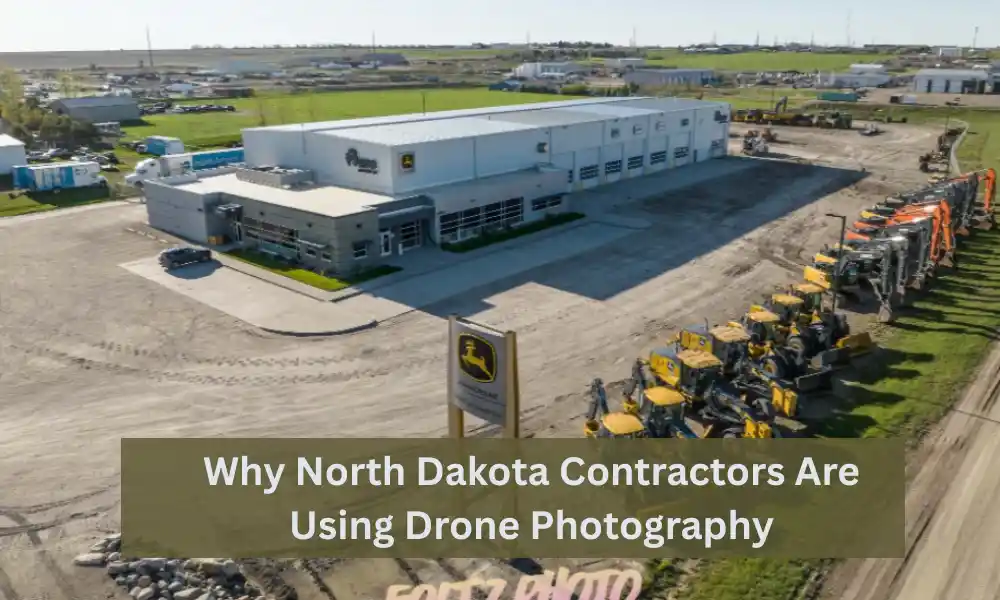
Construction projects across North Dakota are getting larger, more complex, and more competitive. Whether it’s commercial developments, industrial facilities, infrastructure improvements, agricultural construction, or energy projects, contractors need better ways to monitor progress, communicate with clients, and market their work.
That is one reason drone photography has become an essential tool rather than a luxury.
Professional drone photography gives contractors an accurate aerial perspective that traditional ground photography simply cannot provide. From documenting weekly progress to creating impressive marketing content, drones help construction companies make smarter decisions while saving time and money.
At FoltzPhoto, we provide professional drone photography and videography for contractors, developers, engineering firms, and industrial companies throughout North Dakota. Our goal is simple: deliver high-quality imagery that helps projects stay on schedule while showcasing exceptional workmanship.
Why Drone Photography Is Growing Across North Dakota
North Dakota presents unique challenges for construction projects.
Large job sites, changing weather conditions, rural locations, and extensive infrastructure work often make it difficult to capture the entire project from ground level.
Drone photography solves these challenges by providing:
- Complete site visibility
- Accurate project documentation
- Faster inspections
- Better communication
- Professional marketing images
- Safer monitoring of difficult areas
Instead of walking hundreds of acres or renting expensive aerial equipment, contractors can receive detailed aerial images in a fraction of the time.
Capture the Entire Job Site in One Image
One of the biggest advantages of drone photography is perspective.
Ground photography is excellent for showing details, but it rarely tells the complete story of a construction project.
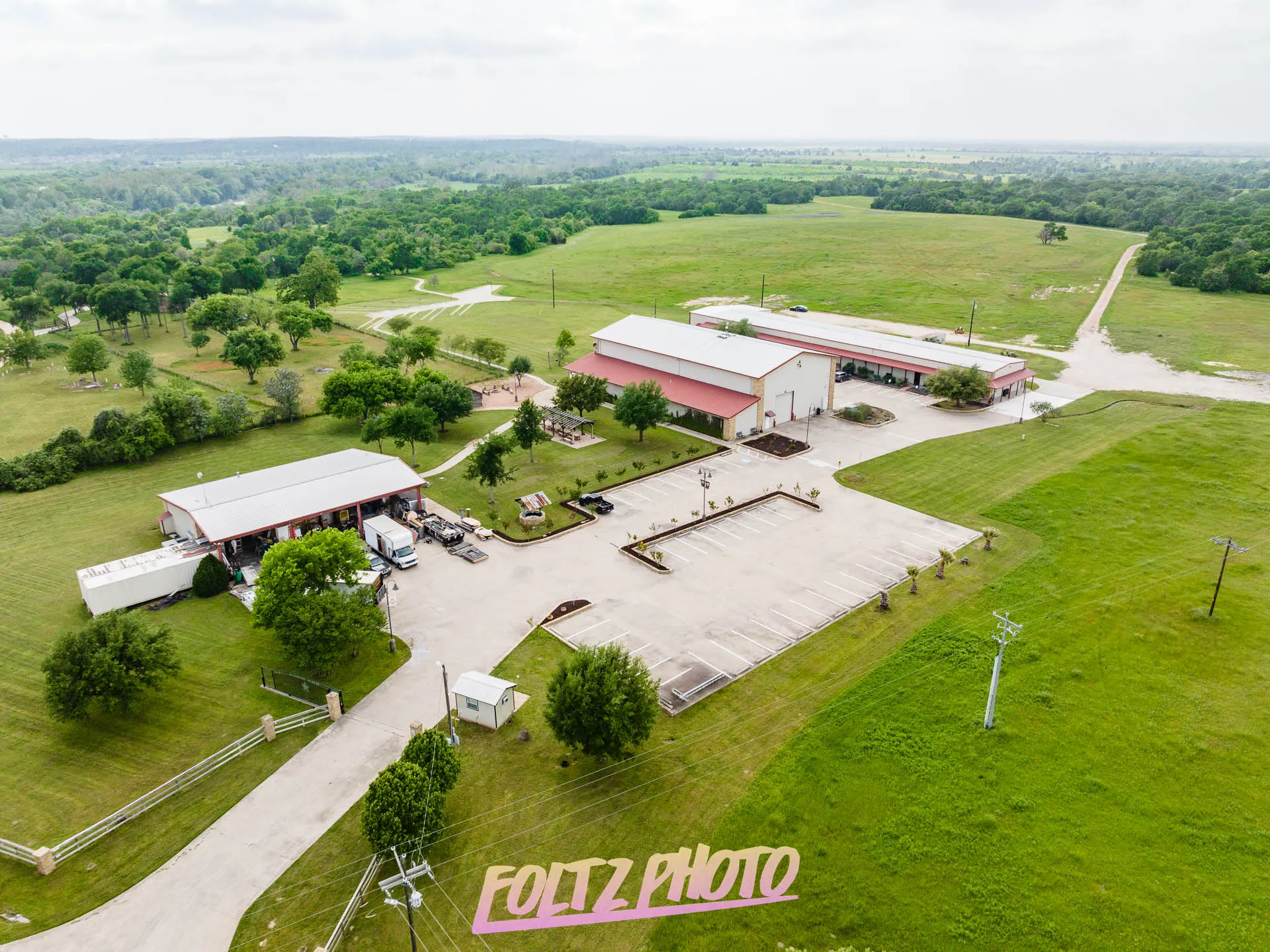
Aerial photography captures:
- Building placement
- Parking lots
- Utility work
- Road access
- Material staging
- Earthmoving progress
- Equipment locations
- Overall project scale
Clients, project owners, architects, and investors immediately understand project status from a single overhead image.
This broader view makes reporting much more effective.
Improve Construction Progress Documentation
Construction projects change quickly.
Weekly or monthly drone photography creates a visual timeline that documents every stage of construction.
Many North Dakota contractors now schedule recurring drone flights to capture:
Site Preparation
- Land clearing
- Excavation
- Grading
- Utilities
Foundation Work
- Footings
- Concrete pours
- Underground systems
Structural Construction
- Steel erection
- Framing
- Roofing
- Exterior finishes
Final Completion
- Landscaping
- Parking lots
- Signage
- Final walkthroughs
These images become valuable records for project managers and clients alike.
Reduce Unnecessary Site Visits
Many project owners, investors, architects, and stakeholders cannot visit construction sites every week.
Drone photography allows them to review progress remotely.
Instead of scheduling multiple site visits, contractors can provide:
- High-resolution aerial photos
- Progress videos
- Before-and-after comparisons
- Interactive project updates
This improves communication while saving everyone valuable time.
Improve Communication With Clients
One common challenge in construction is helping clients understand project progress.
Technical reports and spreadsheets only tell part of the story.
Professional aerial imagery makes updates much easier to understand.
Clients can clearly see:
- Completed work
- Current construction phases
- Remaining work
- Equipment activity
- Overall project development
Visual reporting builds confidence and reduces misunderstandings.
Increase Safety During Project Monitoring
Some construction areas are difficult—or unsafe—to access.
Examples include:
- Roof inspections
- Tall structures
- Bridges
- Industrial facilities
- Excavation sites
- Large earthmoving operations
Instead of placing personnel in potentially hazardous locations, drones safely capture detailed imagery from above.
This allows contractors to inspect progress without unnecessary risk.
Showcase Your Work to Win Future Projects
Construction photography isn’t only for documentation.
It is also one of the most valuable marketing investments contractors can make.
Professional aerial images help companies:
- Update their website
- Improve proposal presentations
- Create social media content
- Build project portfolios
- Produce annual reports
- Impress potential clients
When owners compare contractors, companies with professional project photography often appear more established and experienced.
Highlight Large Commercial and Industrial Projects
North Dakota is home to diverse industries, including:
- Commercial construction
- Manufacturing
- Agriculture
- Oil and gas
- Renewable energy
- Transportation
- Warehousing
- Municipal infrastructure
Many of these projects cover dozens or even hundreds of acres.
Drone photography provides a complete visual record that isn’t possible with traditional photography.
This is especially valuable for:
- Distribution centers
- Industrial plants
- Highway construction
- Pipelines
- Utility installations
- Wind energy projects
- Agricultural facilities
Create Professional Marketing Videos
Drone video brings construction projects to life.
Instead of static photos, contractors can showcase:
- Smooth aerial flyovers
- Equipment in operation
- Building progress
- Completed developments
- Time-lapse project highlights
These videos perform exceptionally well on:
- Company websites
- YouTube
- Sales presentations
- Trade shows
Professional aerial video helps potential clients understand the scale and quality of your work.
Support Insurance and Project Records
Construction documentation isn’t only useful during active projects.
Professional aerial imagery creates permanent records that can help with:
- Insurance documentation
- Warranty records
- Dispute resolution
- Change order verification
- Historical project archives
Having accurate visual records often saves significant time if questions arise later.
Save Time Compared to Traditional Aerial Photography
Years ago, aerial construction photography required:
- Helicopters
- Airplanes
- Expensive scheduling
- Limited availability
Today, drones provide:
- Faster deployment
- Lower costs
- More frequent updates
- Better image quality
- Flexible scheduling
This makes professional aerial documentation practical for projects of nearly every size.
Why Professional Drone Photography Matters
While consumer drones are widely available, construction projects benefit from experienced drone operators.
Professional drone photography provides:
Consistent Image Quality
Images are captured with professional equipment and edited for clarity, color, and detail.
Safe Flight Operations
Construction environments require careful planning around equipment, workers, and restricted airspace.
Reliable Scheduling
Regular progress photography only works when flights happen consistently throughout the project.
High-Resolution Deliverables
Professional images are suitable for:
- Marketing
- Reports
- Printing
- Large displays
- Websites
- Presentations
Industries That Benefit Most
Drone photography supports a wide range of North Dakota businesses, including:
- General contractors
- Commercial builders
- Industrial contractors
- Civil engineering firms
- Developers
- Property managers
- Municipal governments
- Manufacturing companies
- Agricultural construction firms
- Energy companies
Whether the project lasts one month or several years, aerial documentation creates lasting value.
Frequently Asked Questions: How often should construction projects be photographed?
Many contractors schedule drone photography weekly, bi-weekly, or monthly depending on project size and reporting needs.
Can drone photography be used during active construction?
Yes. Professional drone operators coordinate with site personnel to safely capture imagery without interrupting construction activities.
Are drone photos useful after the project is complete?
Absolutely. Completed project photography is valuable for marketing, client presentations, proposals, and future business development.
Can drone photography cover large industrial sites?
Yes. Drone photography is ideal for documenting expansive commercial, industrial, agricultural, and infrastructure projects across North Dakota.
What types of files are delivered?
Clients typically receive professionally edited, high-resolution photos and, upon request, cinematic aerial video suitable for web, print, and presentations.
Why Contractors Across North Dakota Choose FoltzPhoto
Construction companies need more than beautiful aerial images—they need dependable documentation that supports project management, client communication, and business growth.
FoltzPhoto works with contractors across North Dakota to deliver professional drone photography that is timely, consistent, and tailored to each project’s needs. Whether you’re documenting a new commercial development, monitoring an industrial expansion, or creating marketing materials for completed work, we provide imagery that highlights your craftsmanship from every angle.
Our focus is on producing clear, high-quality visuals that help contractors keep stakeholders informed, strengthen their portfolios, and showcase the scale of their work.
Explore Related FoltzPhoto Services
If you’re looking for comprehensive visual documentation, these services complement drone photography:
- Construction Photography – Capture every stage of your project with detailed ground-level and aerial images.
- Commercial Photography – Professional imagery for businesses, developers, and commercial properties.
- Industrial Photography – Showcase manufacturing facilities, industrial operations, and heavy equipment.
- Aerial Drone Photography & Videography – High-resolution drone photos and cinematic aerial video for projects of all sizes.
- Project Progress Photography – Scheduled site visits that create a complete visual timeline from groundbreaking to completion
Final Thoughts
Drone photography has become one of the most valuable tools available to North Dakota contractors. It provides a safer, faster, and more effective way to document construction progress, communicate with clients, monitor large job sites, and market completed projects.
As construction projects continue to grow in size and complexity, having professional aerial imagery is no longer just an added feature—it is an important part of modern project management and business development.