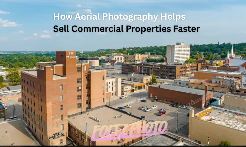
Selling a commercial property isn’t just about listing square footage and waiting for buyers to call. Whether you’re marketing an office building, warehouse, retail center, industrial facility, apartment complex, or development land, buyers want to understand the property’s full potential before scheduling a visit.
That’s where professional aerial photography makes a significant difference.
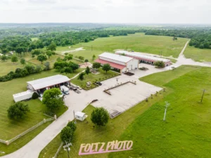
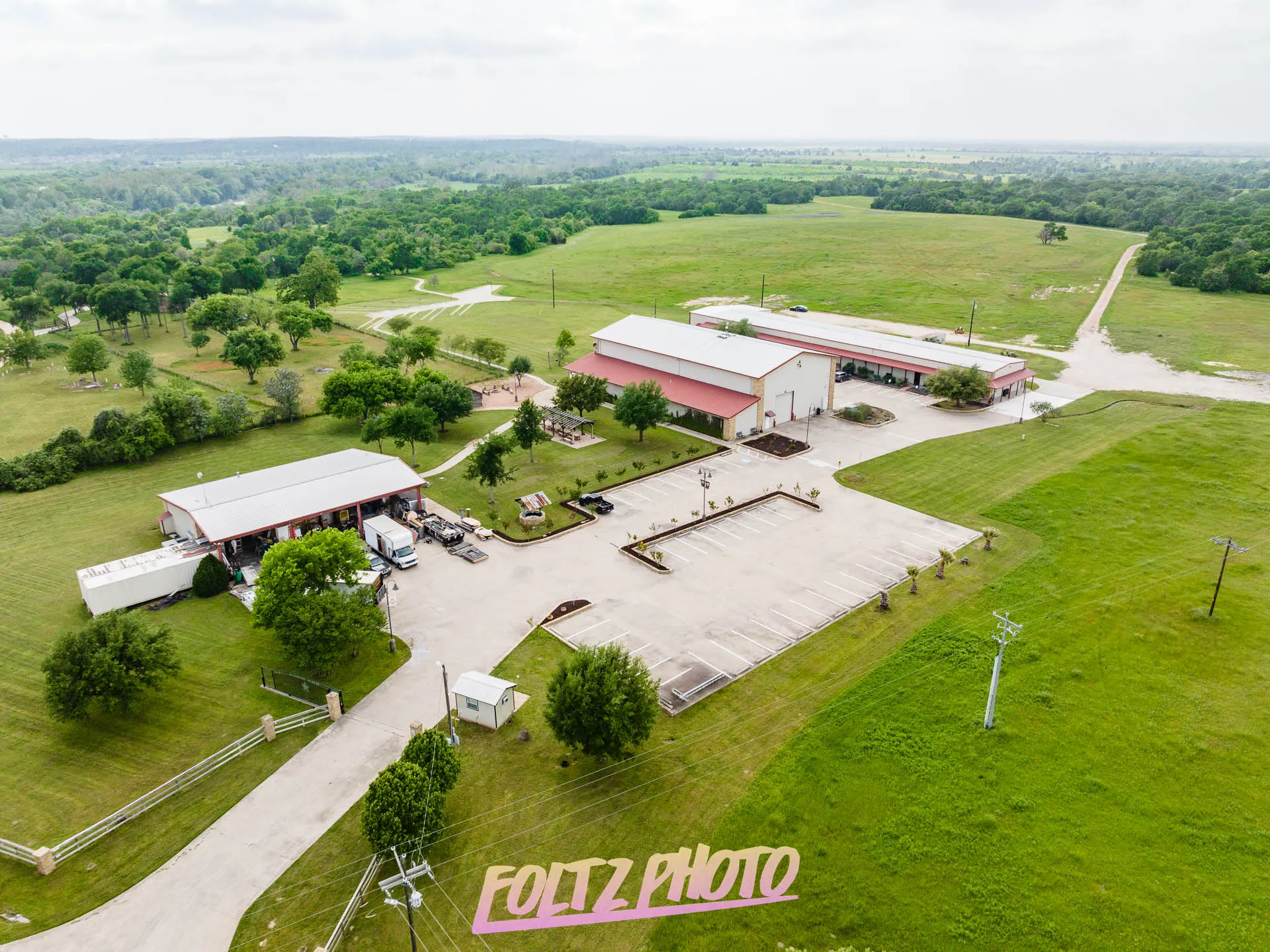
High-quality drone photography gives buyers a perspective they simply can’t get from ground-level images. It highlights property boundaries, surrounding infrastructure, parking, road access, neighboring businesses, and overall scale, information that often influences purchasing decisions.
If you’re marketing commercial real estate in North Dakota, professional aerial imagery can help your listings stand out, generate more interest, and ultimately help properties sell faster.
Why First Impressions Matter in Commercial Real Estate
Today’s buyers begin their search online.
Before contacting an agent, requesting documents, or touring a property, they typically review online listings and compare multiple properties within minutes.
Listings with poor or limited photography often get overlooked.
Professional aerial photography immediately creates a stronger first impression by showing:
- Entire property layout
- Building size and footprint
- Parking areas
- Access roads
- Nearby highways
- Loading docks
- Landscaping
- Adjacent businesses
- Surrounding neighborhoods
Instead of guessing how everything fits together, buyers can understand the property almost instantly.
That confidence often leads to more inquiries and scheduled showings.
Aerial Photography Shows the Complete Property
Traditional photos only capture individual angles.
Drone photography tells the complete story.
For commercial properties, buyers often care just as much about what’s around the building as the building itself.
Aerial images can clearly showcase:
- Property boundaries
- Multiple buildings
- Storage yards
- Truck access
- Rail access
- Highway proximity
- Nearby developments
- Employee parking
- Customer entrances
- Green space
- Expansion opportunities
This broader perspective helps buyers evaluate whether the property fits their operational needs.
Buyers Understand Location Faster
Commercial real estate is heavily influenced by location.
Drone imagery helps communicate location advantages much better than maps alone.
Potential buyers can instantly see:
- Distance to interstate highways
- Nearby commercial districts
- Surrounding industrial parks
- Retail traffic
- Residential developments
- Schools
- Airports
- Railroads
- Distribution centers
Instead of imagining where the property sits, buyers see it with their own eyes.
This builds trust and speeds up decision-making.
Large Properties Need Aerial Coverage
Many commercial properties simply cannot be captured from ground level.
Examples include:
- Industrial facilities
- Manufacturing plants
- Distribution centers
- Agricultural businesses
- Office campuses
- Apartment complexes
- Shopping centers
- Hotels
- Construction sites
- Development land
Drone photography captures the entire site in one frame, allowing buyers to appreciate the property’s full scale.
Aerial Photography Highlights Property Value
Commercial buyers aren’t just purchasing buildings.
They’re investing in opportunities.
Professional aerial imagery helps showcase valuable features like:
- Large parking capacity
- Future expansion space
- Excellent visibility
- Corner lots
- Highway frontage
- Outdoor storage
- Loading areas
- Truck circulation
- Multiple access points
- Well-maintained landscaping
These features may not be obvious from standard photography but become immediately visible from above.
Better Listings Generate More Interest
Commercial buyers often compare dozens of listings online.
Professional aerial photography helps your business stand apart.
Listings with drone imagery typically appear:
- More professional
- Better maintained
- Higher value
- More transparent
- Easier to understand
When buyers spend more time viewing your listing, they’re more likely to request additional information or schedule a showing.
Drone Photography Reduces Buyer Questions
Without aerial images, buyers frequently ask:
- How much parking is available?
- Where are the loading docks?
- What surrounds the building?
- Is there room for expansion?
- How close is the highway?
- What’s the traffic flow like?
- Is truck access easy?
Professional aerial photography answers many of these questions before buyers even make contact.
That saves time for brokers, property managers, and sellers.
Perfect for Marketing Industrial Properties
Industrial real estate benefits especially from aerial imagery.
Buyers often need to evaluate:
- Truck routes
- Storage yards
- Rail connections
- Equipment access
- Building layout
- Utility infrastructure
- Property boundaries
- Security fencing
Ground-level images simply cannot communicate these details effectively.
For industrial properties across North Dakota, drone photography provides valuable context that buyers appreciate.
Showcase Development Land Clearly
Vacant commercial land can be difficult to market using traditional photography.
Aerial photography helps buyers understand:
- Parcel shape
- Topography
- Road access
- Nearby businesses
- Utilities
- Existing developments
- Potential building sites
- Drainage features
This information allows investors and developers to visualize future possibilities.
Improve Commercial Property Marketing Across Every Platform
Professional aerial images work across multiple marketing channels.
They can be used for:
- MLS listings
- Commercial real estate websites
- Company websites
- Social media campaigns
- Digital advertising
- Email marketing
- Property brochures
- Investment presentations
- Print materials
- Sales proposals
High-resolution images continue providing value long after the initial listing.
Drone Photography Builds Buyer Confidence
Commercial purchases involve significant investments.
Professional imagery demonstrates transparency.
When buyers clearly understand the property before visiting, they’re often more confident in moving forward.
That confidence can lead to:
- More qualified inquiries
- Faster showings
- Better offers
- Shorter sales cycles
Professional Photography Reflects Professional Management
Marketing quality influences buyer perception.
Professional aerial photography communicates that:
- The property is well maintained.
- The seller is serious.
- Marketing has been thoughtfully prepared.
- Accurate visual information is available.
This creates a positive impression before buyers even visit.
Commercial Properties That Benefit Most
Nearly every commercial property can benefit from aerial photography, including:
- Office buildings
- Retail centers
- Industrial facilities
- Manufacturing plants
- Warehouses
- Apartment communities
- Hotels
- Medical buildings
- Schools
- Churches
- Agricultural facilities
- Business parks
- Commercial land
- Mixed-use developments
- Construction projects
If the property’s location, size, or surrounding area influences its value, aerial photography is an excellent investment.
Why Professional Drone Photography Matters
Flying a drone is only one part of creating effective commercial marketing images.
Professional aerial photographers understand:
- FAA regulations
- Safe flight operations
- Lighting conditions
- Camera settings
- Composition
- Property presentation
- Commercial marketing needs
- Image editing
- High-resolution delivery
The result is imagery that looks polished, accurate, and ready for marketing.
Why North Dakota Commercial Properties Benefit from Aerial Photography
North Dakota features a wide variety of commercial properties spread across large geographic areas.
Many businesses operate on expansive sites where ground-level photography cannot capture the property’s full value.
Professional drone photography is especially useful for:
- Industrial facilities
- Energy sector properties
- Agricultural operations
- Manufacturing plants
- Distribution centers
- Commercial developments
- Retail centers
- Office complexes
- Construction projects
Because buyers often travel long distances to evaluate commercial properties, detailed aerial imagery helps them make informed decisions before visiting in person.
Why Choose FoltzPhoto for Commercial Aerial Photography?
At FoltzPhoto, we specialize in professional commercial photography and drone services throughout North Dakota.
We understand what commercial buyers, developers, brokers, contractors, and property owners need to see when evaluating a property.
Our aerial photography services are designed to showcase every property’s strengths with clean, high-resolution imagery suitable for online marketing, printed materials, and investment presentations.
Whether you’re marketing an industrial facility, office building, commercial land, warehouse, or retail property, we’ll create imagery that helps your listing stand out in a competitive market.
Our Commercial Photography Services Include
- Commercial aerial photography
- FAA-compliant drone photography
- Industrial photography
- Construction progress photography
- Commercial real estate photography
- Drone videography
- Marketing photography for businesses
- Facility documentation
- Development site photography
- Corporate branding imagery
Every project is approached with attention to detail, safety, and professional image quality.
Frequently Asked Questions
Does aerial photography really help sell commercial properties?
Yes. Aerial photography gives buyers a complete understanding of the property’s size, layout, access, and surroundings, often generating more interest and improving marketing performance.
What types of commercial properties benefit most?
Industrial buildings, warehouses, office complexes, shopping centers, hotels, development land, apartment communities, agricultural facilities, and manufacturing sites all benefit from aerial imagery.
Can drone photography be used for marketing materials?
Absolutely. Images can be used on websites, MLS listings, brochures, advertising campaigns, presentations, social media, and printed marketing materials.
Is drone photography legal for commercial use?
Yes, when performed by a properly licensed and FAA-compliant commercial drone operator.
Do you serve all of North Dakota?
Yes. FoltzPhoto provides commercial photography and aerial drone services throughout North Dakota and surrounding areas for businesses, contractors, developers, and commercial property owners.
Ready to Showcase Your Commercial Property?
If you’re preparing to sell, lease, or market a commercial property, professional aerial photography can make a lasting first impression and help buyers better understand its value before they ever step on-site.
At FoltzPhoto, we provide professional commercial photography and drone imaging across North Dakota, creating high-quality visuals that help businesses, brokers, and property owners market with confidence. Whether it’s an industrial facility, retail center, office building, development site, or commercial land, we’re here to capture your property from the angles that matter most.
Contact FoltzPhoto today to discuss your project and discover how professional aerial photography can help your commercial property stand out in today’s competitive market.